Storm library

Browse live and recent hail maps.

Review storm footprints, hail swaths, reports, and replay access. Create a free account to save your setup and move into map access when a storm matters.

Search filters
Clear
Newest storms first by default.
Don't see your storm? Request a qualifying storm map and we'll email you when it is ready.
Showing 1-22 of 22 storms · Page 1 of 1
‹ 1 ›
Request a storm map

Tell us about the storm and we'll build the map. Once it's published you'll get an email and can purchase it from the library — just like any other event.

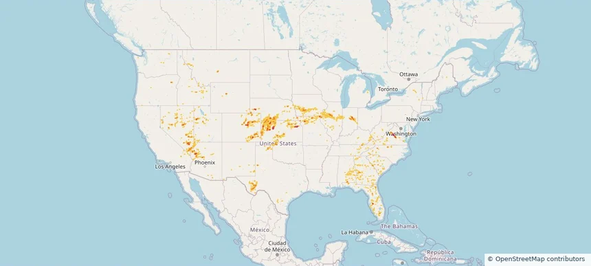
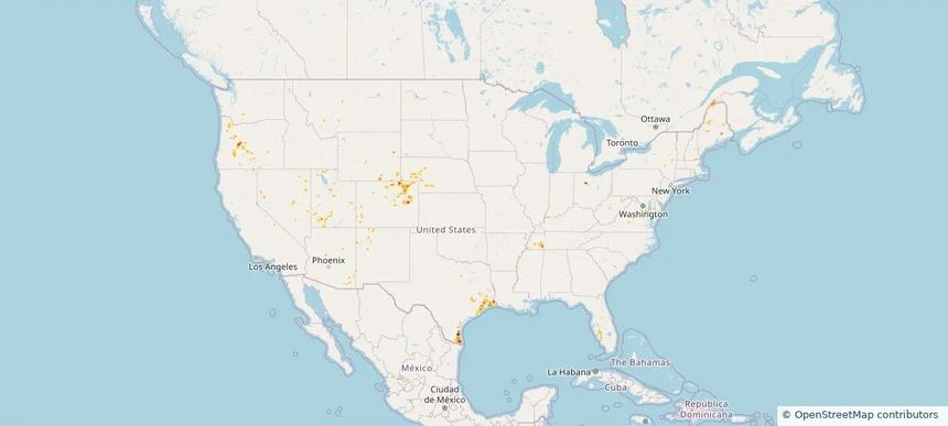
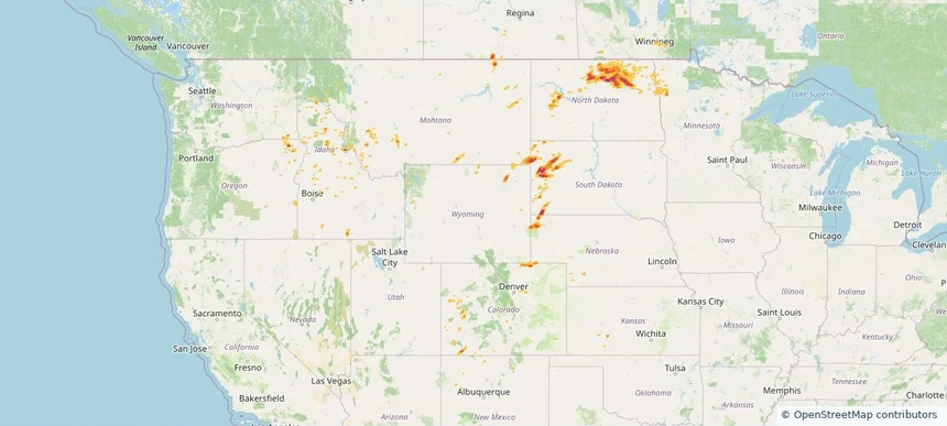
Nationwide Daily Hail & Wind Map - August 29, 2026 — regional hail footprint preview
Storm footprint preview
Aug 28, 2026 10:00 PM to Aug 30, 2026 1:45 AM CST

Nationwide Daily Hail & Wind Map - August 29, 2026

Hail as large as 1.75 inches was reported near 1 mile northeast of Lynndyl, UT. Wind up to 115 mph was reported near 1 mile northeast of Lynndyl, UT. The storm had 7 official hail reports.

Affected states: National, AL, AZ, CO, FL, GA, IA, KS, MN, MT, NE, NV, ND, SD, TX, UT, WA, WY
3.47 inRadar size estimate 318,804Population Affected 151,786Houses Affected Hail · WindHazards FreeAccount signup
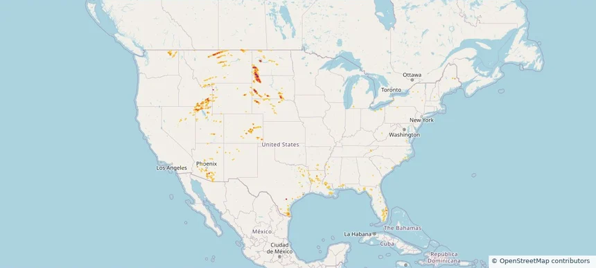
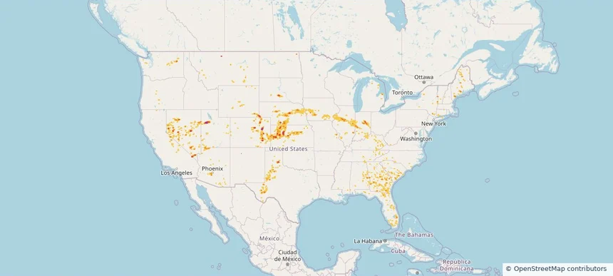
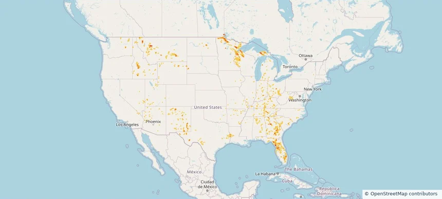
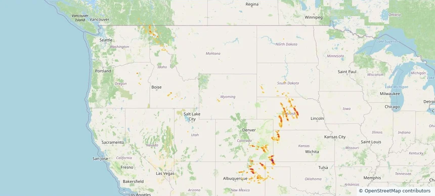
Nationwide Daily Hail, Wind & Tornado Map - August 23, 2026 — regional hail footprint preview
Storm footprint preview
Aug 22, 2026 10:00 PM to Aug 24, 2026 1:45 AM CST

Nationwide Daily Hail, Wind & Tornado Map - August 23, 2026

Hail as large as 1.75 inches was reported near 10 miles south-southwest of Reva, SD. Wind up to 86 mph was reported near 2 miles west-northwest of Malta, MT. A tornado was reported near 5 miles east-northeast of Sorum, SD. The storm had 13 official hail reports.

Affected states: National, AL, AZ, CA, CO, FL, ID, LA, MS, MT, NE, NV, NM, NC, ND, OH, PA, SC, SD, TN, TX, UT, WA, WY
3.0 inRadar size estimate 225,924Population Affected 98,035Houses Affected Hail · Wind · TornadoHazards FreeAccount signup
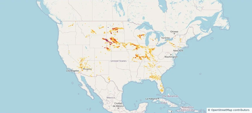
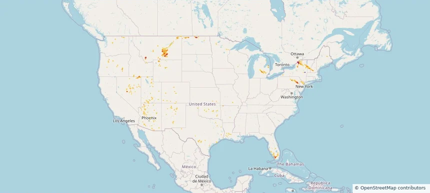
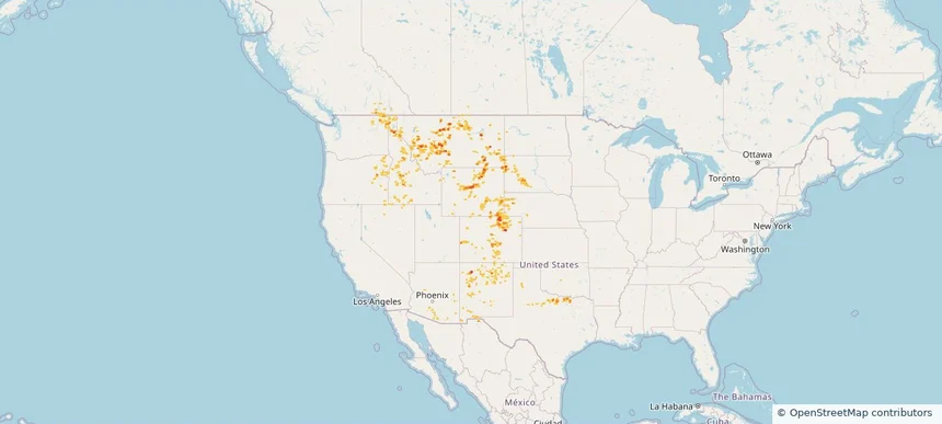
Nationwide Daily Hail, Wind & Tornado Map - August 22, 2026 — regional hail footprint preview
Storm footprint preview
Aug 21, 2026 10:00 PM to Aug 23, 2026 1:45 AM CST

Nationwide Daily Hail, Wind & Tornado Map - August 22, 2026

Hail as large as 2.50 inches was reported near Highland, IL. Wind up to 94 mph was reported near 3 miles north-northwest of Taber, ID. 3 tornadoes were reported, including one near 3 miles northwest of Ramey, PA. The storm had 34 official hail reports.

Affected states: National, AL, AZ, AR, CO, FL, GA, ID, IL, IN, KS, KY, LA, MD, MI, MS, MO, MT, NE, NV, NM, NC, OH, OK, PA, SC, SD, TN, TX, UT, VA, WA, WV, WI, WY
3.0 inRadar size estimate 1,337,049Population Affected 603,295Houses Affected Hail · Wind · TornadoHazards FreeAccount signup
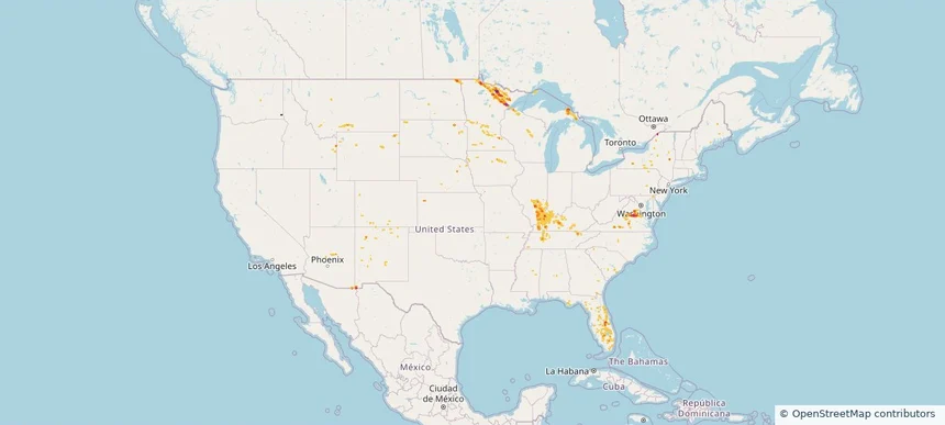
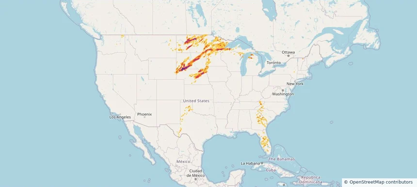
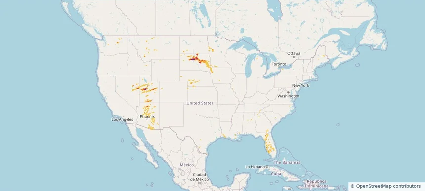
Nationwide Daily Hail, Wind & Tornado Map - August 16, 2026 — regional hail footprint preview
Storm footprint preview
Aug 15, 2026 10:00 PM to Aug 17, 2026 1:45 AM CST

Nationwide Daily Hail, Wind & Tornado Map - August 16, 2026

Hail as large as 1.50 inches was reported near 6.5 miles south of Bayard, NE. Wind up to 91 mph was reported near 6 miles west-southwest of Eli, NE. 2 tornadoes were reported, including one near 1 mile north-northeast of Harshaville, PA. The storm had 10 official hail reports.

Affected states: National, AL, AR, CO, FL, GA, ID, IL, IN, IA, KS, KY, LA, MD, MS, MO, MT, NE, NM, NC, OH, OK, OR, PA, SC, SD, TX, VA, WA, WV, WY
2.5 inRadar size estimate 541,792Population Affected 227,789Houses Affected Hail · Wind · TornadoHazards FreeAccount signup
Nationwide Daily Hail, Wind & Tornado Map - August 14, 2026 — regional hail footprint preview
Storm footprint preview
Aug 13, 2026 10:00 PM to Aug 15, 2026 1:45 AM CST

Nationwide Daily Hail, Wind & Tornado Map - August 14, 2026

Hail as large as 3.50 inches was reported near Union Mills, VA. Wind up to 104 mph was reported near 2 miles east-northeast of Barracks, VA. A tornado was reported near 2 miles east-northeast of Commerce City, CO. The storm had 9 official hail reports.

Affected states: National, AL, AZ, CA, CO, FL, GA, ID, IL, IN, IA, KS, KY, MO, MT, NE, NV, NM, NY, NC, OH, OK, OR, SC, TN, TX, UT, VA, WA, WV, WY
2.95 inRadar size estimate 874,845Population Affected 394,687Houses Affected Hail · Wind · TornadoHazards FreeAccount signup
Nationwide Daily Hail, Wind & Tornado Map - August 13, 2026 — regional hail footprint preview
Storm footprint preview
Aug 12, 2026 10:00 PM to Aug 14, 2026 1:45 AM CST

Nationwide Daily Hail, Wind & Tornado Map - August 13, 2026

Hail as large as 1.75 inches was reported near 4 miles east-northeast of Alexandria, IN. Wind up to 118 mph was reported near 1 mile south-southwest of New Haven Airport, CT. 6 tornadoes were reported, including one near 4 miles southwest of Cornlea, NE. The storm had 10 official hail reports.

Affected states: National, AL, AZ, CA, CO, CT, FL, GA, IL, IN, IA, KS, KY, ME, MA, MI, MS, MO, MT, NE, NV, NH, NM, NY, NC, OH, OK, OR, RI, SC, SD, TN, TX, UT, VT, VA, WA, WY
2.5 inRadar size estimate 981,714Population Affected 420,167Houses Affected Hail · Wind · TornadoHazards FreeAccount signup
Nationwide Daily Hail, Wind & Tornado Map - August 12, 2026 — regional hail footprint preview
Storm footprint preview
Aug 11, 2026 10:00 PM to Aug 13, 2026 1:51 AM CST

Nationwide Daily Hail, Wind & Tornado Map - August 12, 2026

Hail as large as 3.50 inches was reported near 11 miles west of Hot Springs, SD. Wind up to 118 mph was reported near 1 mile south-southwest of New Haven Airport, CT. 5 tornadoes were reported, including one near 14 miles north of Reno Junction, WY. The storm had 22 official hail reports.

Affected states: National, AL, AZ, CA, CO, CT, FL, GA, ID, IL, IN, IA, KY, MI, MN, MO, MT, NE, NV, NM, NY, NC, ND, OH, PA, SC, SD, TN, TX, UT, VT, VA, WA, WI, WY
3.5 inRadar size estimate 1,558,433Population Affected 672,634Houses Affected Hail · Wind · TornadoHazards FreeAccount signup
Nationwide Daily Hail, Wind & Tornado Map - July 26, 2026 — regional hail footprint preview
Storm footprint preview
Jul 25, 2026 10:00 PM to Jul 27, 2026 1:45 AM CST

Nationwide Daily Hail, Wind & Tornado Map - July 26, 2026

Hail as large as 2.50 inches was reported near Bumpass, VA. Wind up to 84 mph was reported near 25 miles east-southeast of Wright, WY. A tornado was reported near 2 miles east of Glenwood, IL. The storm had 6 official hail reports.

Affected states: National, AZ, CO, FL, GA, ID, IL, IN, IA, KY, MI, MN, MT, NE, NM, NY, ND, SC, SD, TN, VA, WA, WI, WY
3.5 inRadar size estimate 347,654Population Affected 155,021Houses Affected Hail · Wind · TornadoHazards FreeAccount signup
Nationwide Daily Hail, Wind & Tornado Map - July 24, 2026 — regional hail footprint preview
Storm footprint preview
Jul 23, 2026 10:00 PM to Jul 25, 2026 1:45 AM CST

Nationwide Daily Hail, Wind & Tornado Map - July 24, 2026

Hail as large as 3.00 inches was reported near Forbes, ND. Wind up to 102 mph was reported near 10 miles south of Wing, ND. 2 tornadoes were reported, including one near Middle River, MN. The storm had 7 official hail reports.

Affected states: National, AZ, CO, FL, GA, ID, KS, MN, MT, NV, NM, NY, ND, OK, SC, SD, TX, UT, WA, WY
3.5 inRadar size estimate 164,378Population Affected 78,798Houses Affected Hail · Wind · TornadoHazards FreeAccount signup
Nationwide Daily Hail & Wind Map - July 23, 2026 — regional hail footprint preview
Storm footprint preview
Jul 22, 2026 10:00 PM to Jul 24, 2026 1:45 AM CST

Nationwide Daily Hail & Wind Map - July 23, 2026

Hail as large as 1.75 inches was reported near Towner, CO. Wind up to 86 mph was reported near 12 miles southwest of Plymell, KS. The storm had 4 official hail reports.

Affected states: National, AZ, CO, FL, ID, KS, MT, NE, NV, NM, NY, OH, OK, OR, TX, UT, WA, WY
3.0 inRadar size estimate 76,757Population Affected 32,188Houses Affected Hail · WindHazards FreeAccount signup
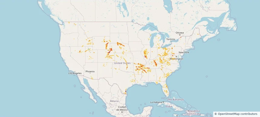
Nationwide Daily Hail, Wind & Tornado Map - July 17, 2026 — regional hail footprint preview
Storm footprint preview
Jul 16, 2026 10:00 PM to Jul 18, 2026 1:45 AM CST

Nationwide Daily Hail, Wind & Tornado Map - July 17, 2026

Hail as large as 1.00 inches was reported near 5 miles west-northwest of West Valley, MT. Wind up to 83 mph was reported near 8 miles south-southeast of Ulm, MT. A tornado was reported near 8 miles south-southeast of Bremen, ND. The storm had 6 official hail reports.

Affected states: National, AL, AZ, AR, CA, FL, GA, ID, IL, IN, KY, LA, MI, MN, MS, MT, NV, NM, NC, ND, OH, SC, SD, TN, TX, UT, VA, WA, WV, WI, WY
2.0 inRadar size estimate 527,789Population Affected 227,488Houses Affected Hail · Wind · TornadoHazards FreeAccount signup
Nationwide Daily Hail, Wind & Tornado Map - July 15, 2026 — regional hail footprint preview
Storm footprint preview
Jul 14, 2026 10:00 PM to Jul 16, 2026 1:45 AM CST

Nationwide Daily Hail, Wind & Tornado Map - July 15, 2026

Hail as large as 2.75 inches was reported near 1 mile north-northeast of Contact, NV. Wind up to 85 mph was reported near 7 miles north of Lavina, MT. 3 tornadoes were reported, including one near 2 miles east-northeast of San Antonio, TX. The storm had 2 official hail reports.

Affected states: National, AZ, AR, CO, FL, ID, LA, ME, MI, MT, NV, NH, NJ, NM, NY, ND, OK, OR, PA, TX, UT, VT, WA, WY
3.0 inRadar size estimate 422,959Population Affected 169,795Houses Affected Hail · Wind · TornadoHazards FreeAccount signup
Nationwide Daily Hail, Wind & Tornado Map - June 29, 2026 — regional hail footprint preview
Storm footprint preview
Jun 28, 2026 10:00 PM to Jun 30, 2026 1:45 AM CST

Nationwide Daily Hail, Wind & Tornado Map - June 29, 2026

Hail as large as 4.00 inches was reported near 4 miles east of Horace, ND. Wind up to 151 mph was reported near 4 miles east-southeast of Holabird, SD. 9 tornadoes were reported, including one near 1 mile south of Andover, SD. The storm had 32 official hail reports.

Affected states: National, FL, GA, IA, MI, MN, MT, NE, NC, ND, OK, SC, SD, TN, TX, VA, WA, WI, WY
4.88 inRadar size estimate 764,166Population Affected 357,426Houses Affected Hail · Wind · TornadoHazards FreeAccount signup
Nationwide Daily Hail, Wind & Tornado Map - June 24, 2026 — regional hail footprint preview
Storm footprint preview
Jun 23, 2026 10:00 PM to Jun 25, 2026 1:45 AM CST

Nationwide Daily Hail, Wind & Tornado Map - June 24, 2026

Hail as large as 3.20 inches was reported near 5 miles south of Dailey, CO. Wind up to 96 mph was reported near 1 mile north-northwest of Akron, CO. 8 tornadoes were reported, including one near 3 miles west-southwest of Huntley, IL. The storm had 47 official hail reports.

Affected states: National, AL, AZ, AR, CA, CO, FL, ID, IL, IN, IA, KS, LA, MI, MN, MS, MO, MT, NE, NV, NM, OK, TX, UT, WA, WI, WY
3.5 inRadar size estimate 1,897,132Population Affected 786,049Houses Affected Hail · Wind · TornadoHazards FreeAccount signup
Nationwide Daily Hail, Wind & Tornado Map - May 29, 2026 — regional hail footprint preview
Storm footprint preview
May 28, 2026 10:00 PM to May 30, 2026 2:00 AM CST

Nationwide Daily Hail, Wind & Tornado Map - May 29, 2026

Hail as large as 1.75 inches was reported near 5 miles north of Happy, TX. Wind up to 89 mph was reported near 5 miles south of Tieton, WA. 2 tornadoes were reported, including one near 1 mile northeast of North Hammond, NY. The storm had 5 official hail reports.

Affected states: National, AR, CO, FL, GA, ID, KS, MS, MO, MT, NE, NM, NY, OK, OR, SD, TX, UT, WA, WY
3.0 inRadar size estimate 86,598Population Affected 42,353Houses Affected Hail · Wind · TornadoHazards FreeAccount signup
Nationwide Daily Hail & Wind Map - May 28, 2026 — regional hail footprint preview
Storm footprint preview
May 27, 2026 10:00 PM to May 29, 2026 2:00 AM CST

Nationwide Daily Hail & Wind Map - May 28, 2026

Hail as large as 1.75 inches was reported near 15 miles east of Burns, OR. Wind up to 92 mph was reported near Riley, OR. The storm had 7 official hail reports.

Affected states: National, CO, FL, ID, MT, NV, NM, NY, NC, OR, TX, WA, WY
2.94 inRadar size estimate 110,450Population Affected 52,983Houses Affected Hail · WindHazards FreeAccount signup
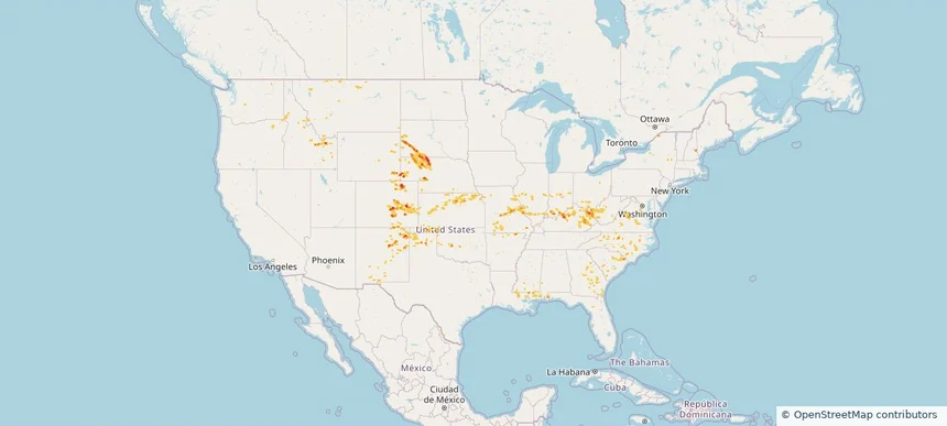
Nationwide Daily Hail, Wind & Tornado Map - May 16, 2026 — regional hail footprint preview
Storm footprint preview
May 15, 2026 10:00 PM to May 17, 2026 2:00 AM CST

Nationwide Daily Hail, Wind & Tornado Map - May 16, 2026

Hail as large as 3.00 inches was reported near 4 miles west of Amherst, NE. Wind up to 104 mph was reported near Concordia, KS. 10 tornadoes were reported, including one near 4 miles east-southeast of Benton, WI. The storm had 46 official hail reports.

Affected states: National, AR, CO, FL, IL, IN, IA, KS, KY, MI, MS, MO, NE, NY, OH, OK, WA, WI, WY
4.09 inRadar size estimate 881,870Population Affected 393,969Houses Affected Hail · Wind · TornadoHazards FreeAccount signup
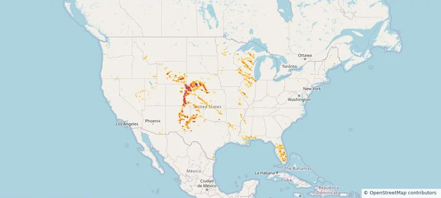
Nationwide Daily Hail, Wind & Tornado Map - April 27, 2026 — regional hail footprint preview
Storm footprint preview
Apr 26, 2026 10:00 PM to Apr 28, 2026 2:00 AM CST

Nationwide Daily Hail, Wind & Tornado Map - April 27, 2026

Hail as large as 4.00 inches was reported near 8 miles south-southwest of Piney Park, MO. Wind up to 92 mph was reported near Latham, IL. 33 tornadoes were reported, including one near Hallowell, KS. The storm had 117 official hail reports.

Affected states: National, AR, CO, FL, IL, IN, IA, KS, KY, MS, MO, MT, NE, NV, NY, OH, OK, TN, TX, WA, WI
3.0 inRadar size estimate 6,151,962Population Affected 2,684,634Houses Affected Hail · Wind · TornadoHazards FreeAccount signup
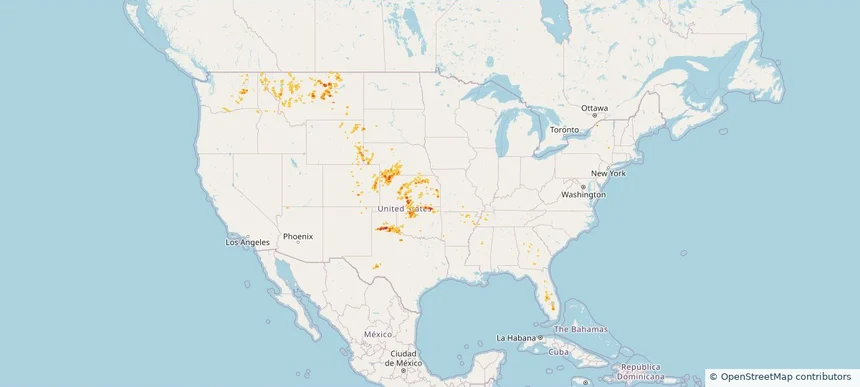
Historical Hail — 2025-09-11 — regional hail footprint preview
Storm footprint preview
Sep 11, 2025 7:00 AM to Sep 12, 2025 7:00 AM CST

Historical Hail — 2025-09-11

Hail as large as 1.00 inches was reported near Falfa, COLORADO. Wind up to 76 mph was reported near 1 mile south-southwest of Lander, WY. 3 tornadoes were reported, including one near San Juan, UTAH. The storm had 4 official hail reports.

Affected states: National, CO, ID, KS, MN, MT, NE, NM, ND, OR, SD, UT, WA, WY
2.5 inRadar size estimate 39,169Population Affected 20,041Houses Affected Hail · Wind · TornadoHazards FreeAccount signup
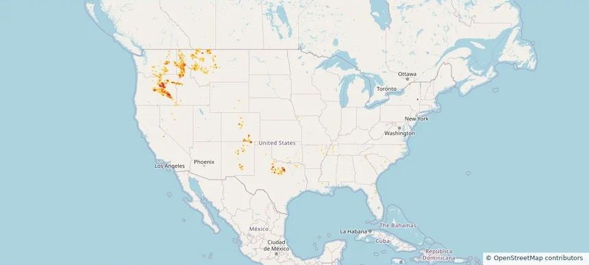
Historical Hail — 2025-08-29 — regional hail footprint preview
Storm footprint preview
Aug 29, 2025 7:00 AM to Aug 30, 2025 7:00 AM CST

Historical Hail — 2025-08-29

Hail as large as 1.50 inches was reported near Sturgis, OKLAHOMA. Wind up to 109 mph was reported near Cheyenne, COLORADO. A tornado was reported near Mercer, NORTH DAKOTA. The storm had 5 official hail reports.

Affected states: National, CO, ID, KS, MT, NE, NM, OK, OR, SD, TX, WA, WY
3.0 inRadar size estimate 40,693Population Affected 19,559Houses Affected Hail · Wind · TornadoHazards FreeAccount signup
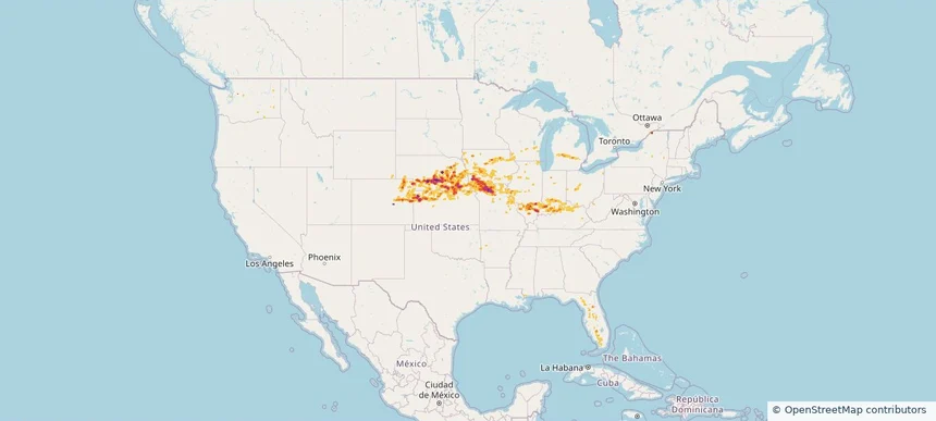
Historical Hail — 2025-07-31 — regional hail footprint preview
Storm footprint preview
Jul 31, 2025 7:00 AM to Aug 1, 2025 7:00 AM CST

Historical Hail — 2025-07-31

Hail as large as 1.25 inches was reported near (Cys)Cheyenne Airport, WYOMING. Wind up to 86 mph was reported near 10 miles west of Knolls, UT. 4 tornadoes were reported, including one near Bernalillo, NEW MEXICO. The storm had 4 official hail reports.

Affected states: National, AZ, CO, ID, MT, NE, NV, NM, OR, SD, TX, UT, WA, WY
2.5 inRadar size estimate 274,271Population Affected 118,870Houses Affected Hail · Wind · TornadoHazards FreeAccount signup
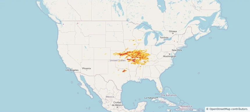
Frequently asked questions

Can I search hail maps by coverage area?

Yes. The storm library supports coverage-area filtering so you can find hail maps and hail swaths in a target service area.

What kinds of storms appear in the HailMapr library?

The library focuses on published hail events, including ready storm maps and live storms once hail has been detected and a public swath is available.

Are HailMapr storm pages useful for roofers and adjusters?

Yes. They are built to help roofers, adjusters, restoration teams, and property owners review storm footprints before purchase.