Storm library

Browse live and recent hail maps.

Review storm footprints, hail swaths, reports, and replay access. Create a free account to save your setup and move into map access when a storm matters.

Search filters
Clear
Newest storms first by default.
Don't see your storm? Request a qualifying storm map and we'll email you when it is ready.
Showing 1-19 of 19 storms · Page 1 of 1
‹ 1 ›
Request a storm map

Tell us about the storm and we'll build the map. Once it's published you'll get an email and can purchase it from the library — just like any other event.

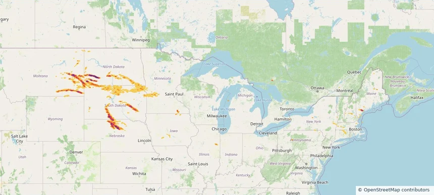
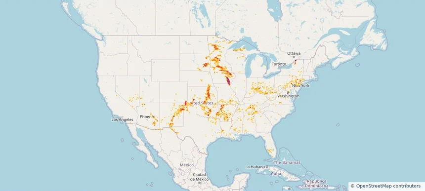
Nationwide Daily Hail, Wind & Tornado Map - August 7, 2026 — regional hail footprint preview
Storm footprint preview
Aug 6, 2026 10:00 PM to Aug 8, 2026 1:53 AM CST

Nationwide Daily Hail, Wind & Tornado Map - August 7, 2026

Hail as large as 4.50 inches was reported near Ryan, IA. Wind up to 113 mph was reported near 1 mile east-southeast of Prairieburg, IA. 4 tornadoes were reported, including one near 2 miles north of Waverly, IA. The storm had 26 official hail reports.

Affected states: National, AL, AZ, AR, CA, CO, CT, DE, FL, GA, IL, IN, IA, KS, KY, LA, MD, MA, MI, MN, MS, MO, NE, NV, NJ, NM, NY, OH, OK, PA, SD, TN, TX, UT, VA, WV, WI
3.5 inRadar size estimate 1,654,669Population Affected 689,946Houses Affected Hail · Wind · TornadoHazards FreeAccount signup
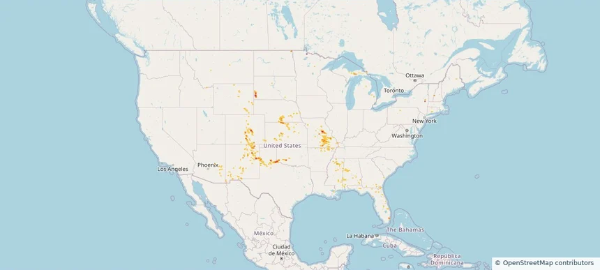
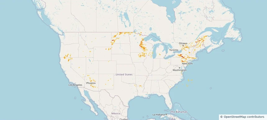
Nationwide Daily Hail, Wind & Tornado Map - July 31, 2026 — regional hail footprint preview
Storm footprint preview
Jul 30, 2026 10:00 PM to Aug 1, 2026 1:45 AM CST

Nationwide Daily Hail, Wind & Tornado Map - July 31, 2026

Hail as large as 1.75 inches was reported near Argyle, SD. Wind up to 89 mph was reported near 2 miles west-northwest of Hereford, TX. 5 tornadoes were reported, including one near 4 miles south-southwest of Oak Hill, MO. The storm had 3 official hail reports.

Affected states: National, AL, AZ, AR, CO, CT, FL, GA, ID, IL, IA, KS, MI, MS, MO, MT, NE, NM, NY, OK, SD, TX, WY
2.0 inRadar size estimate 325,282Population Affected 130,987Houses Affected Hail · Wind · TornadoHazards FreeAccount signup
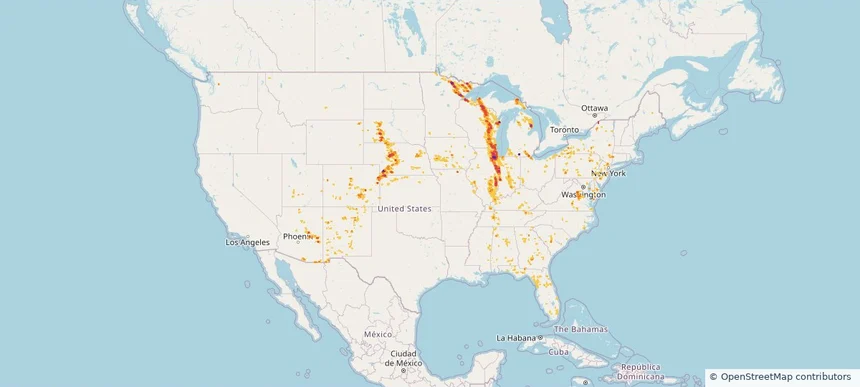
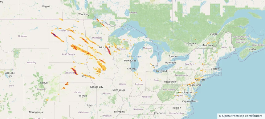
Nationwide Daily Hail, Wind & Tornado Map - July 27, 2026 — regional hail footprint preview
Storm footprint preview
Jul 26, 2026 10:00 PM to Jul 28, 2026 1:45 AM CST

Nationwide Daily Hail, Wind & Tornado Map - July 27, 2026

Hail as large as 4.50 inches was reported near 2 miles northwest of Gresham, WI. Wind up to 120 mph was reported near 2 miles west-southwest of Goodenow, IL. 15 tornadoes were reported, including one near 2 miles east of Glenwood, IL. The storm had 19 official hail reports.

Affected states: National, AL, AZ, CO, CT, FL, GA, ID, IL, IN, IA, KS, KY, MD, MI, MN, MS, MO, MT, NE, NJ, NM, NY, NC, OH, PA, SC, SD, TN, UT, VA, WI, WY
4.55 inRadar size estimate 10,080,339Population Affected 4,225,062Houses Affected Hail · Wind · TornadoHazards FreeAccount signup
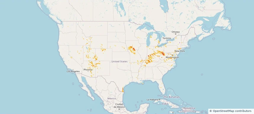
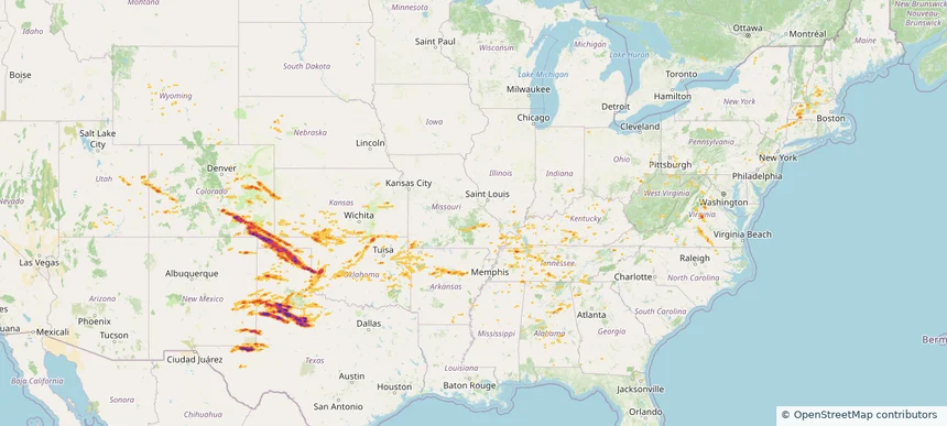
Nationwide Daily Hail, Wind & Tornado Map - July 21, 2026 — regional hail footprint preview
Storm footprint preview
Jul 20, 2026 10:00 PM to Jul 22, 2026 1:45 AM CST

Nationwide Daily Hail, Wind & Tornado Map - July 21, 2026

Hail as large as 2.25 inches was reported near Doswell, VA. Wind up to 92 mph was reported near Centerville, IA. 44 tornadoes were reported, including one near 7 miles north of Grantsville, WV. The storm had 5 official hail reports.

Affected states: National, AZ, AR, CA, CO, CT, DE, FL, GA, ID, IL, IN, IA, KY, LA, MD, MI, MO, NE, NV, NJ, NM, NY, NC, OH, OK, PA, TN, TX, UT, VA, WV, WI, WY
2.47 inRadar size estimate 1,923,332Population Affected 812,169Houses Affected Hail · Wind · TornadoHazards FreeAccount signup
Bristol, CT — July 04, 2026 — regional hail footprint preview
Storm footprint preview

Local hail summary for the Bristol area: 20.73 square miles of estimated ground-hail footprint; highest mapped band 2+ inches. 1 official hail report(s) within the summary area. Exposure estimates are not confirmed property damage. Open the map to explore the full coverage included in your access. Statistics cover the mapped hail footprint inside the Census boundary of Bristol, CT, not the entire region. The place had 60,833 residents in the 2020 Census. A boundary intersection does not mean the whole community was hit. Estimated housing exposure: 23,125 units in 1-inch-or-larger bands, including 16,580 in 1.5-inch-or-larger bands and 794 in 2-inch-or-larger bands.

Affected states: Bristol area, CT
2+ inRadar size estimate 54,501Population Affected 24,511Houses Affected HailHazards FreeAccount signup
New Britain, CT — July 04, 2026 — regional hail footprint preview
Storm footprint preview

Local hail summary for the New Britain area: 1.33 square miles of estimated ground-hail footprint; highest mapped band 1+ inches. 1 official hail report(s) within the summary area. Exposure estimates are not confirmed property damage. Open the map to explore the full coverage included in your access. Statistics cover the mapped hail footprint inside the Census boundary of New Britain, CT, not the entire region. The place had 74,135 residents in the 2020 Census. A boundary intersection does not mean the whole community was hit. Estimated housing exposure: 165 units in 1-inch-or-larger bands, including 0 in 1.5-inch-or-larger bands and 0 in 2-inch-or-larger bands.

Affected states: New Britain area, CT
1+ inRadar size estimate 2,321Population Affected 1,013Houses Affected HailHazards FreeAccount signup
Torrington, CT — July 04, 2026 — regional hail footprint preview
Storm footprint preview

Local hail summary for the Torrington area: 10.25 square miles of estimated ground-hail footprint; highest mapped band 2+ inches. 0 official hail report(s) within the summary area. Exposure estimates are not confirmed property damage. Open the map to explore the full coverage included in your access. Statistics cover the mapped hail footprint inside the Census boundary of Torrington, CT, not the entire region. The place had 35,515 residents in the 2020 Census. A boundary intersection does not mean the whole community was hit. Estimated housing exposure: 9,269 units in 1-inch-or-larger bands, including 6,263 in 1.5-inch-or-larger bands and 1,398 in 2-inch-or-larger bands.

Affected states: Torrington area, CT
2+ inRadar size estimate 22,379Population Affected 10,942Houses Affected HailHazards FreeAccount signup
Nationwide Daily Hail, Wind & Tornado Map - July 4, 2026 — regional hail footprint preview
Storm footprint preview
Jul 3, 2026 10:00 PM to Jul 5, 2026 1:43 AM CST

Nationwide Daily Hail, Wind & Tornado Map - July 4, 2026

Hail as large as 3.00 inches was reported near Bristol, CT. Wind up to 106 mph was reported near 3 miles northwest of Norman, OK. 5 tornadoes were reported, including one near 2 miles east-southeast of Everly, IA. The storm had 40 official hail reports.

Affected states: National, AL, AR, CO, CT, DE, FL, GA, IL, IN, IA, KS, KY, LA, MD, MI, MN, MS, MO, MT, NE, NJ, NM, NY, NC, ND, OH, OK, PA, RI, SC, SD, TN, TX, VA, WV, WI, WY
4.16 inRadar size estimate 3,632,510Population Affected 1,561,106Houses Affected Hail · Wind · TornadoHazards FreeAccount signup
Nationwide Daily Hail, Wind & Tornado Map - July 2, 2026 — regional hail footprint preview
Storm footprint preview
Jul 1, 2026 10:00 PM to Jul 3, 2026 1:45 AM CST

Nationwide Daily Hail, Wind & Tornado Map - July 2, 2026

Hail as large as 3.50 inches was reported near 4 miles east-southeast of Maynard, IA. Wind up to 121 mph was reported near 2 miles north-northwest of Huron, SD. 6 tornadoes were reported, including one near 6 miles south of Gann Valley, SD. The storm had 39 official hail reports.

Affected states: National, AL, AR, CO, CT, FL, GA, ID, IL, IA, KS, KY, LA, ME, MA, MI, MN, MS, MO, MT, NE, NH, NM, NY, NC, ND, OK, SC, SD, TN, TX, UT, VT, WI, WY
3.0 inRadar size estimate 1,989,573Population Affected 827,826Houses Affected Hail · Wind · TornadoHazards FreeAccount signup
Nationwide Daily Hail, Wind & Tornado Map - July 1, 2026 — regional hail footprint preview
Storm footprint preview
Jun 30, 2026 10:00 PM to Jul 2, 2026 1:45 AM CST

Nationwide Daily Hail, Wind & Tornado Map - July 1, 2026

Hail as large as 3.00 inches was reported near 3 miles southeast of Fond Du Lac, WI. Wind up to 98 mph was reported near 1 mile west-southwest of Kingsley Dam, NE. 2 tornadoes were reported, including one near 1 mile south of Stacyville, IA. The storm had 16 official hail reports.

Affected states: National, AL, AR, CO, CT, FL, GA, ID, IA, KS, LA, ME, MA, MI, MN, MS, MT, NE, NH, NM, NY, NC, OK, PA, SD, TN, TX, VT, WI, WY
2.5 inRadar size estimate 1,114,635Population Affected 498,071Houses Affected Hail · Wind · TornadoHazards FreeAccount signup
Nationwide Daily Hail, Wind & Tornado Map - June 12, 2026 — regional hail footprint preview
Storm footprint preview
Jun 11, 2026 10:00 PM to Jun 13, 2026 1:45 AM CST

Nationwide Daily Hail, Wind & Tornado Map - June 12, 2026

Hail as large as 1.75 inches was reported near 2 miles east of Bethany, MO. Wind up to 110 mph was reported near 11 miles northeast of Eva, OK. 12 tornadoes were reported, including one near 3 miles southwest of Andrews, IN. The storm had 9 official hail reports.

Affected states: National, AL, AR, CO, CT, FL, GA, IL, IN, KS, KY, LA, ME, MD, MI, MN, MS, MO, MT, NJ, NM, NY, NC, OH, OK, PA, SC, TN, TX, VT, VA, WV
3.0 inRadar size estimate 509,687Population Affected 219,038Houses Affected Hail · Wind · TornadoHazards FreeAccount signup
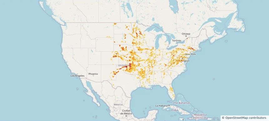
Nationwide Daily Hail, Wind & Tornado Map - June 11, 2026 — regional hail footprint preview
Storm footprint preview
Jun 10, 2026 10:00 PM to Jun 12, 2026 1:45 AM CST

Nationwide Daily Hail, Wind & Tornado Map - June 11, 2026

Hail as large as 3.50 inches was reported near Yorktown, IA. Wind up to 104 mph was reported near Essex, IA. 92 tornadoes were reported, including one near 3 miles northeast of Tallula, IL. The storm had 30 official hail reports.

Affected states: National, AR, CT, DC, FL, IL, IN, IA, KS, KY, MD, MI, MN, MO, NE, NJ, NM, NY, NC, OH, OK, PA, TX, VA, WV, WI
4.11 inRadar size estimate 2,096,539Population Affected 929,827Houses Affected Hail · Wind · TornadoHazards FreeAccount signup
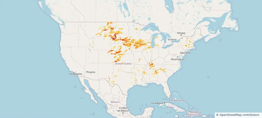
Historical Hail — 2025-09-06 — regional hail footprint preview
Storm footprint preview
Sep 6, 2025 7:00 AM to Sep 7, 2025 7:00 AM CST

Historical Hail — 2025-09-06

Hail as large as 1.00 inches was reported near Oak Grove, GEORGIA. Wind up to 74 mph was reported near Westfield-Barnes Ap, MA. 12 tornadoes were reported, including one near Worcester, MASSACHUSETTS. The storm had 6 official hail reports.

Affected states: National, AL, CT, DE, GA, ME, MD, MA, NH, NJ, NY, NC, PA, SC, VA
1.47 inRadar size estimate 497,283Population Affected 191,578Houses Affected Hail · Wind · TornadoHazards FreeAccount signup
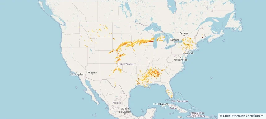
Historical Hail — 2025-08-13 — regional hail footprint preview
Storm footprint preview
Aug 13, 2025 7:00 AM to Aug 14, 2025 7:00 AM CST

Historical Hail — 2025-08-13

Hail as large as 1.25 inches was reported near Webb, NEW HAMPSHIRE. Wind up to 88 mph was reported near 3 miles north-northeast of Harrington, SD. The storm had 4 official hail reports.

Affected states: National, CT, KY, MA, MI, MO, MT, NE, NH, NJ, NY, ND, OH, PA, SD, VT, VA, WV, WY
2.5 inRadar size estimate 57,583Population Affected 25,553Houses Affected Hail · WindHazards FreeAccount signup
Historical Hail — 2025-07-30 — regional hail footprint preview
Storm footprint preview
Jul 30, 2025 7:00 AM to Jul 31, 2025 7:00 AM CST

Historical Hail — 2025-07-30

Hail as large as 1.00 inches was reported near Mooar, IOWA. Wind up to 83 mph was reported near 1 mile west-southwest of Allison, NM. 12 tornadoes were reported, including one near Bernalillo, NEW MEXICO. The storm had 2 official hail reports.

Affected states: National, AL, AZ, AR, CA, CO, CT, FL, GA, ID, IL, IN, IA, KS, LA, MS, MO, NE, NV, NM, NY, OH, OK, OR, PA, TN, TX, UT, VA, WV, WY
2.5 inRadar size estimate 508,659Population Affected 225,784Houses Affected Hail · Wind · TornadoHazards FreeAccount signup
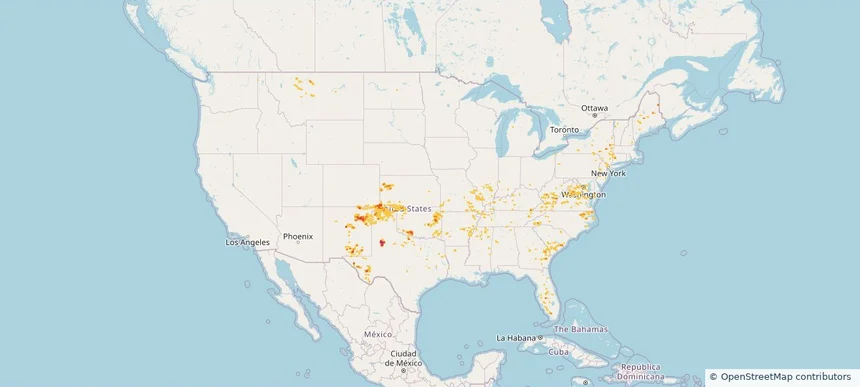
Historical Hail — 2025-07-20 — regional hail footprint preview
Storm footprint preview
Jul 20, 2025 7:00 AM to Jul 21, 2025 7:00 AM CST

Historical Hail — 2025-07-20

Hail as large as 4.50 inches was reported near Rosebud, SOUTH DAKOTA. Wind up to 105 mph was reported near Nh, NH. 10 tornadoes were reported, including one near Cherry, NEBRASKA. The storm had 17 official hail reports.

Affected states: National, CT, IL, IA, ME, MA, MN, MT, NE, NH, NY, ND, SD, VT
4.19 inRadar size estimate 178,663Population Affected 78,058Houses Affected Hail · Wind · TornadoHazards FreeAccount signup
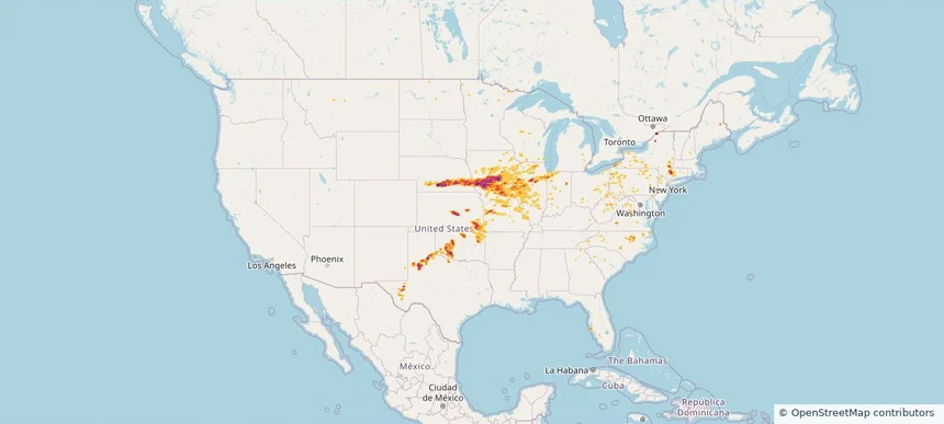
Historical Hail — 2025-07-03 — regional hail footprint preview
Storm footprint preview
Jul 3, 2025 7:00 AM to Jul 4, 2025 7:00 AM CST

Historical Hail — 2025-07-03

Hail as large as 1.75 inches was reported near (Bgm)Binghamton Arpt, NEW YORK. Wind up to 107 mph was reported near 3 miles southeast of Parshall, ND. 4 tornadoes were reported, including one near Bolivar, MISSISSIPPI. The storm had 17 official hail reports.

Affected states: National, AZ, AR, CA, CO, CT, ID, IA, LA, ME, MA, MI, MN, MS, MT, NV, NH, NJ, NM, NY, ND, OR, PA, RI, SD, UT, VT, VA, WI, WY
3.0 inRadar size estimate 826,420Population Affected 365,710Houses Affected Hail · Wind · TornadoHazards FreeAccount signup
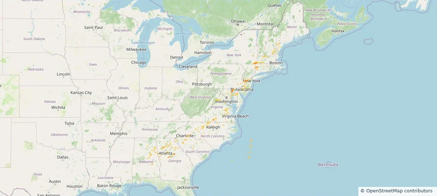
Historical Hail — 2025-06-19 — regional hail footprint preview
Storm footprint preview
Jun 19, 2025 7:00 AM to Jun 20, 2025 7:00 AM CST

Historical Hail — 2025-06-19

Hail as large as 2.50 inches was reported near (Dik)Dickinson Muni, NORTH DAKOTA. Wind up to 104 mph was reported near Beltrami, MINNESOTA. 34 tornadoes were reported, including one near Ottawa, OHIO. The storm had 25 official hail reports.

Affected states: National, CO, CT, DE, DC, IN, IA, KS, ME, MD, MI, MN, NE, NH, NJ, NY, ND, OH, PA, SD, VT, VA, WV, WI
4.09 inRadar size estimate 1,040,687Population Affected 436,626Houses Affected Hail · Wind · TornadoHazards FreeAccount signup
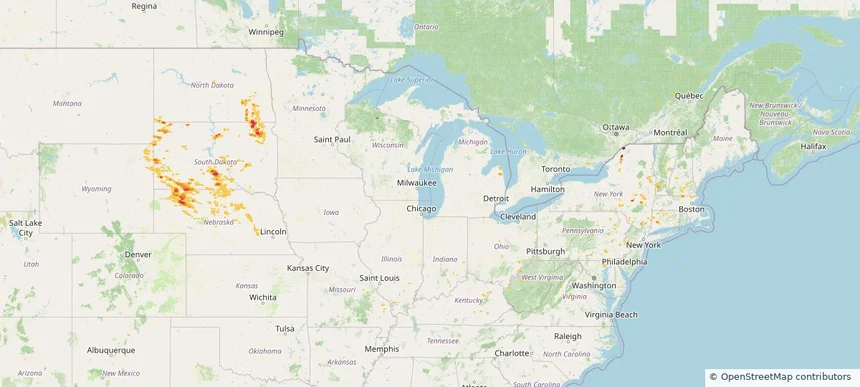
Historical Hail — 2025-06-06 — regional hail footprint preview
Storm footprint preview
Jun 6, 2025 7:00 AM to Jun 7, 2025 7:00 AM CST

Historical Hail — 2025-06-06

Hail as large as 4.00 inches was reported near Hammon, OKLAHOMA. Wind up to 115 mph was reported near Tx, TX. 77 tornadoes were reported, including one near Roosevelt, NEW MEXICO. The storm had 30 official hail reports.

Affected states: National, AL, AR, CO, CT, FL, GA, IL, IN, KS, KY, MA, MS, MO, NE, NH, NM, NY, NC, OH, OK, PA, TN, TX, UT, VT, VA, WV, WY
4.68 inRadar size estimate 697,933Population Affected 305,362Houses Affected Hail · Wind · TornadoHazards FreeAccount signup
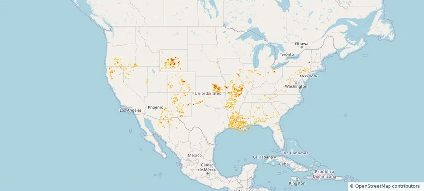
Frequently asked questions

Can I search hail maps by coverage area?

Yes. The storm library supports coverage-area filtering so you can find hail maps and hail swaths in a target service area.

What kinds of storms appear in the HailMapr library?

The library focuses on published hail events, including ready storm maps and live storms once hail has been detected and a public swath is available.

Are HailMapr storm pages useful for roofers and adjusters?

Yes. They are built to help roofers, adjusters, restoration teams, and property owners review storm footprints before purchase.