
Nationwide Daily Hail, Wind & Tornado Map - August 27, 2026
Hail as large as 2.50 inches was reported near 21 miles west-southwest of Merritt Reservoi, NE. Wind up to 112 mph was reported near 3 miles north of Luling, TX. 3 tornadoes were reported, including one near 3 miles northeast of Rosita, CO. The storm had 24 official hail reports.
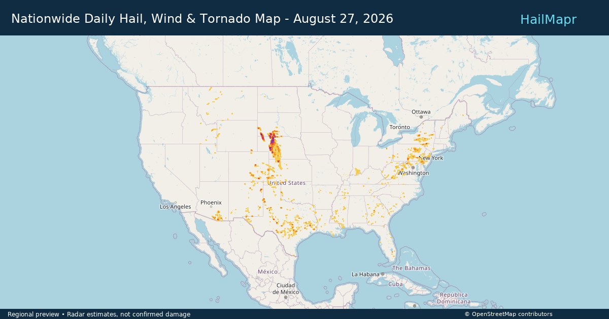
Storm Impact
Potential impact only—not confirmed property damage.
Storm description
Hail as large as 2.50 inches was reported near 21 miles west-southwest of Merritt Reservoi, NE. Wind up to 112 mph was reported near 3 miles north of Luling, TX. 3 tornadoes were reported, including one near 3 miles northeast of Rosita, CO. The storm had 24 official hail reports. The affected area shown on the map covers about 11855.6 square miles.
State storm details
Storm snapshot
What you get
- HailMapr Core Replay with step-by-step hail-track playback
- Heatmap and polygon package for the event window
- Available hail reports with source and location details
- Owned access that remains even if subscriptions end
Frequently asked questions
What does the Nationwide Daily Hail, Wind & Tornado Map - August 27, 2026 hail map show?
This storm page summarizes the mapped hail footprint for Nationwide Daily Hail, Wind & Tornado Map - August 27, 2026, including affected areas, peak hail size, mapped area, and related storm details.
Who uses HailMapr storm pages?
These pages are useful for roofers, adjusters, restoration teams, and property owners who want a storm-specific hail footprint before purchasing map access.
Does this storm include hail core replay?
Yes. HailMapr storm pages highlight Core Replay access so users can review the event window in more detail.